
Cycle across the Beacons

Cycle across the Beacons

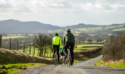
Cycle across the Brecon Beacons National Park using our new touring route, running from Llandeilo in the West to Abergavenny in the East. This new route follows a Roman Road with panoramic views of the Central Beacons, it winds along  lovely country lanes before joining the pretty tow path by the Monmouthshire and Brecon Canal.

Section 1
Llandeilo to Talsarn
Distance 13 miles (21km)
Ascent 1460ft / 445m
Time 1.5-2.5 hours
Description Starting at the railway station, pass though the side streets of Llandeilo town before joining the A483 to cross the river Towy. Pass under the railway in Ffairfach and climb in a southerly direction towards Trapp. Before reaching Trapp the route turns west and climbs on to higher ground offering great views of the Towy Valley and the Black

Mountain. Consider detouring south via Trapp to the magnificent Carreg Cennen Castle. Terrain All sections on road including the main A483 road in Llandeilo, climbing steadily at first then once on higher ground the route undulates. One steep descent and climb either side of Pont Newydd. This is the hilliest section of the entire route. Not family friendly

Section 2
Talsarn to Sennybridge
Distance 11miles (17km)
Ascent 1110ft / 338m
Time 1-2 hours

Description Starting with open views over fields, the surrounding terrain soon changes to a wide, open and exposed area near the Roman Camp, offering stunning views. Travelling east the route passes through a forest area (Usk reservoir to the north), before following undulating lanes into Sennybridge. Terrain Uses unclassified road throughout

on what is the most exposed and highest leg of the route at 1174 feet above sea level (358m). Not family friendly. However, there is an off road route around Usk Reservoir (See MTB Brecon Beacons leaflet- Sennybridge Green).


Section 3
Sennybridge to Brecon
Distance 9 miles (14km)
Ascent 765ft / 233m
Time 1 hour

Description After leaving the army town of Sennybridge the route gently rises and falls along hedge-bound country lanes on the north side of the river Usk. Good views of the whole of the Brecon Beacons can be seen. Terrain Uses well maintained unclassified roads throughout. When entering the urban area of Brecon care should be taken because of parked cars and the increase in traffic volumes. This section is not family friendly

Section 4
Brecon – Llangattock/Crickhowell
Distance 15 miles
Ascent 885ft / 270m
Time 1.5 – 2 hours
Description Leaving the town of Brecon follow the traffic free towpath alongside the Monmouthshire and Brecon canal. This section is also shared with the Taff Trail, NCN route 8. Leaving the canal for the smoother road surface follow the Taff Trail and re-join the B4558 at Pencelli. Pass though the picturesque village of Talybont-on-Usk, climb up and over the Ashford canal tunnel and on to Llangynidr, where the road crosses over the canal. Staying on the B4558, after about 2 miles the road suddenly crosses the canal again. At this point rejoin the canal towpath. As you ride this section you pass the site of the famous Green Man festival on the left and the villages of Dardy and Llangattock. An alternative
to this route is to follow the canal towpath throughout. The canal towpath is family friendly.

Terrain At first the route follows the smooth gravel surface of the towpath of the Monmouthshire and Brecon canal. It then follows well maintained roads until it re-joins the canal towpath. The canal towpath condition varies a great deal and is unsuitable for road bikes. More up to date information on the surface can be found on the Canals and Rivers Trust website. The towpath is shared with walkers and a “Share the space – drop your pace’” approach should be used.

Section 5
Llangattock/Crickhowell to Abergavenny
Distance 8 miles (13km)
Ascent 675ft / 206m
Time 1 hour
Description The Canal towpath is followed until it meets the NCN route 46 at Govilon Wharf. Route 46 is then followed to the heart of Abergavenny. The station is accessed via a well signed link from the bus station.
Terrain The Canal towpath condition varies a great deal and is unsuitable for road bikes. More up to date information on the surface can be found on the Canals and Rivers Trust website. The towpath is shared with walkers and a “Share the space – drop your pace’” approach should be used. The NCN is a mixture of traffic free, well surfaced greenway, highway and riverside path. Suitable for families between Llangattock and Llanfoist.

Download map


Newsletter

Subscribe for latest news, updates & special offers