Cribarth Geotrail
Quarries and crags, folds and fractures
A legacy of quarrying adds detail and drama to the scene.
Getting there
Pay and display parking.
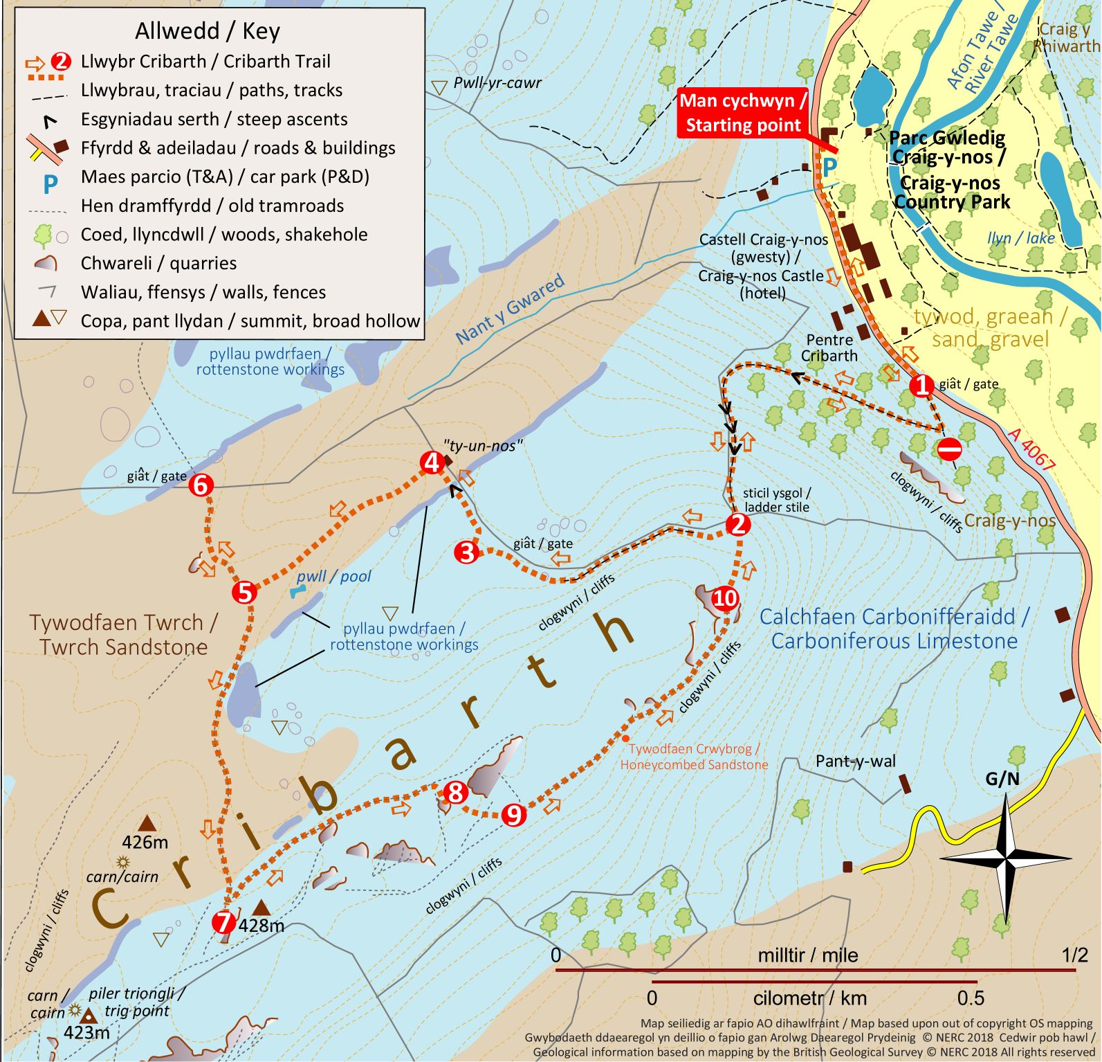
MAP ABOVE stops along the line of the trail are shown on this simplified geological map of the area – blue for limestone, brown for sandstone, yellow for sand and gravel left by water and ice in the valley of the Tawe. Lines and areas shown in purple indicate locations of former rottenstone workings.
rocky sections, notice that the beds of limestone dip steeply to the northwest. Approaching a field gate on your right, venture about 50m up the grassy slopes on your left to take a closer look at the rocks. Chert-filled burrows in limestone
3. Return to the fence/wall and follow it to the left for 100m as it starts to climb a
short bank. Halfway up the bank you cross what looks like a rough ditch running at right angles to the fence.
4. Start by following the outcrop of this rock directly away from the wall/fence, then continue walking southwest along the crest of the broad ridge, passing a shallow pool on your left after 270m as the ridge broadens.
Meet a rough track after a further 70m – the remains of a half-finished tramroad.
5. Turn right, following the twisting track for 100m as it drops down into a gully which cuts across its route.
6. Retracing your steps, go back across the gully to the point at which you joined the tramroad (point 5 on map). Continue along it as it curves uphill to the right and then back left.
7. Retrace your steps for 50m and take the right fork where the tramroads split, continuing along this narrow bench cut into the hillside for 400m to a small quarry set a few metres back on the right.
8. Climb up behind the quarry and, with a larger quarry to your left, drop down to another tramroad. Cross this to another tramroad ahead. Don’t go beyond it – the grounds gets much steeper!9. Turn left along this second tramroad, following it NE for about 500m before it ends in another quarry.
10. Continue beyond the quarry in the same direction and, as you head down a grassy slope, the wall/fence which you followed earlier, comes into view. Head for the ladder-stile you crossed much earlier.
Retrace your steps carefully down the steep hillside to the road. Beware if wet, it is more slippery going downhill! Return to the Country Park, mindful of traffic on the road.
Download leaflet
Please follow the Countryside Code.
This land is grazed by sheep and horses – please keep dogs on a short lead on the hill.